
The Pacific Northwest Travel Photography Guide
Sunset at Little Lake Tipsoo
The Pacific Northwest is a region which as the name suggests encompasses the states of Washington, Oregon and some of California. It also happens to be a landscape photographer’s paradise. I had heard of this location and seen some photos before but as I put my travel guide together I began to realize what an epic destination it really was. With landscapes ranging from rugged mountains, reflective lakes, waterfalls of all shapes and sizes, spectacular coastlines peppered with sea stacks, dense wild forests, and even rolling sand dunes and deserts one could spend months in the area chasing amazing photographs. My original photo guide had over 60 locations and during my 9 day trip driving 3000 miles we only managed to see 20 of them. These will be covered in this write up but I am certain I will be returning to the area in the near future seeking more epic compositions and photography adventures.
Logistics
Seattle Airport Map
Getting There
If you’re flying into the Pacific Northwest there are major airports in Seattle and Portland depending on whether you want to road trip from the top down or bottom up. There are also smaller airports in between which might also make sense logistically. I personally flew into Seattle and began the road trip in the Olympic Peninsula, continued down the coast and at the border of California made the return trip visiting some of the more inland locations.
Getting Around
The roads are well paved and you can get by for the most part with a regular vehicle though I would recommend some sort of campervan if you want to take advantage of the many campgrounds and stay closer to the photography locations. The only bumpy, off road type conditions I encountered were near Mount Rainier on the drive to Spray Falls.
My Route Map
Campgrounds in Olympic National Park
Lodging
Some of the photography locations are relatively close to a city of some sort but as you get further down the coast they become fewer and far between. For this reason I suggest doing what I did and staying at a combination of campgrounds and AirBnbs as you make your drive up or down the region. Prices for AirBnbs vary but campgrounds can usually be found in the $25 range. There were also many small lodges that didn’t show up on my google map searches so if you get caught without a reservation on a night or two don’t forget to take a drive around the area. That being said there is a big outdoor culture in the Pacific Northwest and everywhere we went there were people in RVs and plenty of RV parks which usually have tent sites. Of course this means that during the high season of summer, availability is limited so be sure to book in advance.
Locations
I will be covering locations somewhat in the order that I visited them making the drive from Seattle down to California and back around. On a further note I made my trip in June of 2020 during the Covid 19 situation and while most businesses and locations were open there were some popular spots I was looking forward to visiting that were closed off due to the pandemic such as La Push Second Beach, Rialto Beach, Multnomah Falls, and a few others. All the more reason to make a return trip later.
Washington Locations
Olympic National Park
Right across from Seattle, about a 4 hour drive, is the majestic Olympic Peninsula home of Olympic National Park. This area is known for its epic beaches and coastlines as well as surprisingly temperate rain forests in its interior. There are several points where you will have to pay a park entrance fee which comes out to $30 per vehicle and is good for 7 days all around the park. Lodging is available around the peninsula in the form of campgrounds.
Olympic National Park Map
Sunset at Ruby Beach
Ruby Beach Map
Ruby Beach
The only beach that was open during my visit to the peninsula was Ruby Beach. While it isn’t the most epic looking it has all of the key features of coastlines in this area including sea stacks, rocky shores, ponds, driftwood, and a forest surrounding which allow for plenty of composition opportunities. I stayed here for sunset, astrophotography and sunrise though sunrise photos on the west coast are only really photogenic with the right amount of cloud cover to catch the light. Ruby Beach works best for sunset and astrophotography with virtually no light pollution to get in the way. Drones are unfortunately not allowed here. Overall a great beach location for seascapes though if I had had the opportunity to access them I think La Push Second Beach and Rialto Beach make for better compositions.
Sunrise at Ruby Beach
Astrophotography at Ruby Beach
Classic Fern Shot at Hoh Rainforest
Hoh Rainforest
The entrance to Hoh Rainforest is one of which you have to pay the park fee. The area itself is quite large but most people visit for the famous Hall of Mosses Trail as did I. General consensus for getting good forest shots is to arrive in the morning when there is a chance for foggy atmospheric conditions and light rays piercing through the trees. You can, however, shoot dense forests at any time of day or weather conditions though you will have to be more creative in your compositions. I actually had a hard time finding a good photo in the Hall of Mosses as the really mossy section was located halfway through the trail in a somewhat open area and didn’t lend itself to easy shots. Wildlife such as Elk are supposedly in the area but I didn’t see any. A classic shot you can get here is using one of the many ferns as your foreground and the mossy trees in the background.
Hoh Rainforest Map
Light Beams at Hoh Rainforest
Sunset at Little Lake Tipsoo
Mount Rainier Map
Mount Rainier National Park/Tipsoo Lake
Mount Rainier is a rather large area a little less than two hours from Seattle. There are many trails to discover here but in my limited schedule I made an attempt to visit Spray Falls to the northwest of the mountain. The road ended up being blocked off a few miles from the end most likely due to the COVID situation. My backup plan was to hit up the picturesque Tipsoo Lake to the east of the mountain for sunset. One thing to keep in mind about Mount Rainier National Park is that even in the summer it can be quite snowy and the temperature can drop below zero at night so it’s important to dress appropriately. BONUS TIP: If you’re flying into Seattle depending on the weather there’s a high chance of seeing the peak of Mount Rainier poking through the clouds so keep you camera ready upon approach.
I visited Tipsoo Lake for sunset and ended up camping out there to shoot the milky way as well. A common misconception is to think that most photos you’ll see on social media are shot at the main Tipsoo Lake facing Mount Rainier when the actual photography spot is at nearby Little Tipsoo Lake right across the road where you’ll see a more open and better composition of the mountain. Astrophotography opportunities will vary throughout the year and I believe the milky way does position itself near the peak at some point but when I was there in July I had to settle for shooting it reflecting over the lake facing more southwards. This spot can be popular with photographers so it’s important to arrive early.
Tipsoo Lake Map
Astrophotography at Little Tipsoo Lake
Columbia River Gorge
Columbia River Gorge
Along the border of Washington and Oregon lies the Columbia River home to the photo location packed National Scenic Area of Columbia River Gorge. Here you’ll find countless trails and waterfalls that you could spend years exploring. I had been looking forward to some of the more famous ones such as Multnomah Falls but due to the COVID lockdown some of these weren’t accessible. If you’re visiting this area be sure to allocate a few days for exploring the locations on both the Washington and Oregon side of the river.
Dalles Mountain Car Milky Way Shot
Columbia Hills State Park
The photos I had seen at Columbia Hills State Park were mostly of rolling hills of blooming flowers. A rusty abandoned car was the subject of some of these compositions. To get here you have to make the one hour and 40 minute drive from Portland and when you arrive at Columbia Hills State Park you follow the signs for Dalles Mountain Ranch. The car itself actually shows up on Google Maps as Dalles Mountain Car and a short walk through the field by the road will bring you there. This location makes for great sunset shots and Milky Way compositions when the alignment is right.
Columbia Hills State Park Map
Long Exposure at Panther Creek Falls
Panther Creek Falls Map
Panther Creek Falls
Panther Creek Falls was one of the waterfalls I was most looking forward to in the Columbia River Gorge area. It lies about an hour and 20 minutes from Portland on the Washington side of the border. A small trail from the parking lot will bring you to the viewpoint on the right or if you take the left you can hike down to the base which I would recommend for better photos. Some of the photos I had seen online showed the waterfall a lot wider than when I visited allowing for an epic selfie shot surrounded by the cascading falls but my guess is that the flow changes throughout the year.
Spirit Falls Long Exposure
Spirit Falls
Spirit Falls was a location that was recommended to me by a photographer at Tipsoo Lake. While I was dealing with the fact that some of the better known waterfalls in Columbia River Gorge were closed I ended up heading to Spirit Falls which, due to the fact that it’s off the beaten path, was definitely going to be accessible. The tricky part in getting there is locating the trail head as it is unmarked. About 100 yards after mile marker 2 you will see a pull out beside the road. Walk to the edge of it and there will be a trail that heads down the ridge into the forest. It can be quite steep for some people so be sure to wear proper hiking boots. At some point you’ll emerge through an opening into an epic scene of the two tiered waterfall that is Spirit Falls. It can be shot in almost any lighting condition as the forest canopy is dense. There are places to shoot the waterfall from above or you can climb down closer to the water’s edge for a different perspective and a nice setup for selfies. Despite its low profile it can get busy so arrive early but overall it’s a highly recommended location.
Spirit Falls Map
Selfie at Spirit Falls
Oregon Locations
Moody Sunset at Haystack Rock
Haystack Rock Map
Cannon Beach/Haystack Rock
Cannon Beach is home of the famous Haystack Rock and also known as the location of several scenes in the movie The Goonies. The rock itself rises 200 ft high and because it’s a bird sanctuary drone flying is prohibited. This is primarily a sunset location but I’ve seen some milky way photography shot here though the light pollution might be something to deal with. Sunrise is possible with the right cloud formations. Finding compositions here can be tricky as there aren't really any interesting foreground elements other than patterns in the sand, long exposures of the receding water, or reflections of the rock itself. Still it’s a classic Oregon coast location and worth a visit.
If you are finding this information helpful please consider donating to the starving artist fund!
Selfie inside the Devil’s Punchbowl
The Devil’s Punchbowl
Continuing down the coast about an hour and a half from the nearest large town of Salem is the Devil’s Punchbowl. The bowl is a large hollowed out hole in the rock with several caves leading into it from which water can enter. It can be viewed from the parking lot but for more interesting shots I would recommend going around the fence and climbing into the bowl. Keep in mind that this should only be done at low tide and the climb itself can be sketchy with the sandstone walls being prone to crumbling. I was able to climb inside easy enough though finding compositions was difficult so I settled on a couple different shots. Getting out of the bowl the same way I climbed in proved to be impossible so I threw my backpack over my head and waded to the beach (another reason why this should only be attempted at low tide).
The Devil’s Punchbowl Map
Long Exposure inside the Devil’s Punchbowl
Moody Long Exposure at Thor’s Well
Thor’s Well Map
Thor’s Well
Thor’s Well is a famous location on the Oregon coast about an hour and 40 minutes from Eugene. It’s a sort of sinkhole formation in the rocks where at high tide the waves push water into causing a geyser like eruption. There’s a parking lot right by the well and a short walk down to the rocks. This location is best shot at high tide though caution must be taken as large waves can suddenly appear and there’s danger of being knocked down or washed out into the surf. This is a great spot for long exposures and I would recommend experimenting with different shutter speeds and techniques though my best shots were of the water receding into the well after erupting.
Sunset at Crater Lake
Crater Lake
The famous Crater Lake lies 3 to 4 hours inland from the coast but is well worth the drive. Under regular circumstances there is a road that circles the entire crater which makes lining up your shot for sunrise, sunset, or astrophotography very easy. When I visited the entrance was only open on the west side so I had to hike to line up my compositions. Inside the lake there’s Wizard Island from where I believe you can take boat tours. Due to its altitude it can get cold at Crater Lake and when I visited in the summer there was still a little snow around. An unpleasant surprise was the large aggressive mosquitoes that descend upon you when you near any of the forested areas. Drones are prohibited here of course so getting shots is not as easy as putting the drone up to capture the entire scene like you can do at Hverfjall Iceland. It’s best to find a section of the crater and take a vertical shot perhaps using some rocks as a foreground or alternatively you can use a telephoto lens for compositions that include Wizard Island. I tried out a pano with mediocre results because there weren't enough clouds in the sky to add drama. Despite these difficulties it’s definitely worth a visit as the view of the large crater is breathtaking.
Crater Lake Map
Milky Way Over Crater Lake

Milky Way Pano Over Crater Lake
Long Exposure at Toketee Falls
Toketee Falls Map
Toketee Falls
If you find yourself in the Crater Lake area you might as well visit a hidden gem known as Toketee Falls which lies about 30 minutes from Crater Lake. This is a very Icelandic looking waterfall as the water cascades over a beautiful basalt lined cliff 133 ft high. From the parking lot it’s a short hike to the viewing platform but for the best shots I would recommend climbing down to the base. The climb can be steep and a little sketchy but there’s a rope to help you down and it’s definitely worth it. Drones can also be flown here for interesting perspectives. Due to the angle of the light I would recommend this spot as more of a sunset location since the waterfall faces west.
Sunset at Painted Hills Overlook
John Day Fossil Beds National Monument/Painted Hills
Painted Hills is smack dab in the middle of the state about two hours from Bend and four hours from Portland. Depending on where you’re coming from I can’t exactly say it’s worth the drive but I wanted to add some variety to my shots so hit up Painted Hills for sunset. It’s essentially a series of mounds striped with different shades of red and orange that make for an interesting scene. Finding classic compositions requires a little work and I settled for a mound in the center of the overlook lit up by the setting sun. There are a couple trails here but the shortest and most popular is Painted Hills Overlook the other one being the Painted Cove Trail.
Toketee Falls Map
Long Exposure at Silver Falls
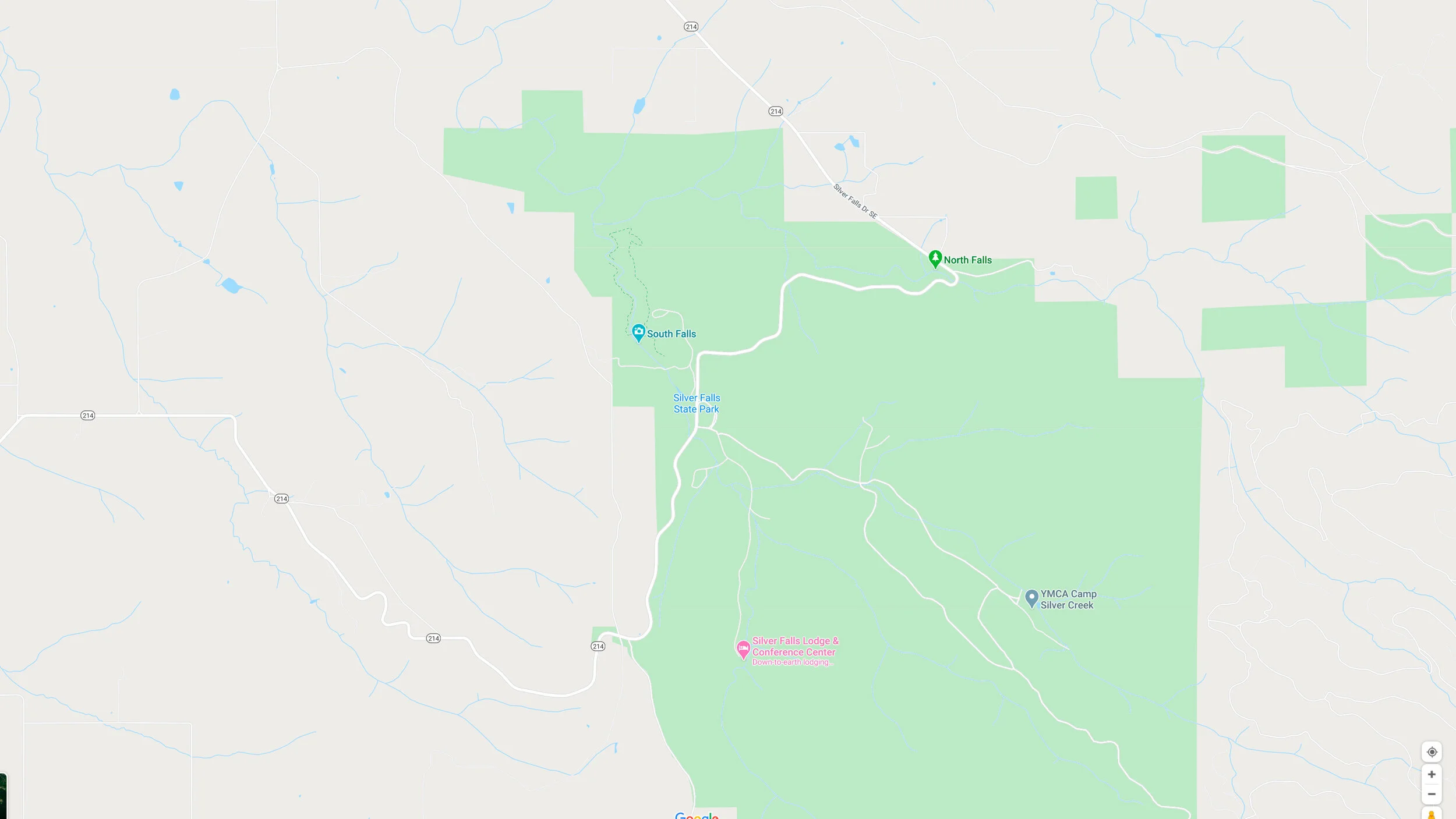
Silver Falls State Park Map
Silver Falls State Park
Silver Falls is located a convenient 30 minutes from Salem and makes an easy location for shooting waterfalls. The main trail here is Trail of Ten Falls which is pretty much what the name suggests. The trail is a 7.9 miles long loop and because I was short on time I only hiked to the first 4 waterfalls and turned around. Long exposures are typically what you’re after here and the waterfalls have a variety of angles they can be photographed from with the trail even going behind some of them. Getting here early is recommended because due to its accessibility and easy hike the trail is very popular.
Long Exposure at Tumalo Falls
Tumalo Falls
Tumalo Falls is a surprisingly large and easily accessible waterfall about 30 minutes from Bend but not to be confused with Tumalo State Park which is another location. The trail from the parking lot will take you to a decent but distant view of the waterfall from ground level or you can take a trail that leads to a platform at the top of the falls. I’m more of a fan of lower, closer compositions so I found a trail along the river that leads right up to the base though the water vapor is quite heavy so I backtracked a bit and still found a decent composition using the river as a leading line. Drones are allowed here so there is an opportunity for a variety of shots.
Tumalo Falls Map
Drone Shot at Tumalo Falls
Drone Selfie at Samuel H Boardman State Scenic Corridor
Samuel H Boardman State Scenic Corridor Map
Samuel H Boardman State Scenic Corridor
This region is down at the southern coast of Oregon almost by the border and is one that I was very much looking forward to on my trip. It’s essentially 18 miles of epic, rocky, forested signature Oregon coastlines which make it the perfect photographer’s playground. In addition to all this drones are allowed here (though beware of the aggressive seagulls) and there are endless opportunities for compositions. I’ll go over some of the better known locations below but I strongly recommend just wandering the trails if you have time in search of undiscovered gems.
Sunset at Samuel H Boardman
Drone Selfie at Natural Boardman
Natural Bridges
Natural Bridges is one of the better known areas and is marked and easy to find. The trail to the left of the parking lot will take you to a platform overlooking the coast and “natural bridge” formation. If you’re traveling with multiple people you can take turns hiking down to the bridge and taking selfies, otherwise if you don’t want to leave your camera unattended the only other way is with a drone. To the right of the parking lot you’ll find the trail that leads down to the bridge. Finding the way can be tricky as the trail splits multiple times but as long as you keep an idea of your heading you’ll see where the trail splits and you take a left and begin the steep part of the trail down to the bridge. There are numerous compositions to be found at the bridge and you can also cross it to the other side for a different perspective. Sunset is the best time to visit here though I recommend arriving early to properly navigate the trails. This can also be a good astrophotography location depending on where the milky way is lining up.
National Bridges Map
Astrophotography at Natural Bridges
Milky Way Pano at Secret Beach
Secret Beach Map
Secret Beach
Judging from the number of photographers that show up to this location it’s probably not so secret but can be a little tricky to find. There is a pullout ⅓ mile south of mile post 345 at the beginning of a short trail through the forest. You’ll emerge through an opening and the scene before you is what makes Secret Beach so epic. Like something out of an adventure novel the cove is dotted with small rocky islands some with trees making perfect compositional elements for sunset and astrophotography. Be sure to shoot a blue hour shot for compositing in later because light painting might not be possible due to distance and fog at night. There are compositions to be found from the top viewpoint, below on the beach, and depending on the tide you might be able to cross to the right side of the beach. As mentioned there is a high probability of other photographers being here even at night though most of them stay for an hour and move on.
Milky Way Selfie at Secret Beach
Astrophotography at Secret Beach
Milky Way Selfie at Secret Beach
Whaleshead Beach
This beach is one I visited but didn’t end up shooting. It has potential for a good sunset location due to the sea stacks but I wasn’t particularly inspired. I have also seen milky way photography shot here but on my visit using the Photopills app I could see it wasn’t going to align correctly.
Whaleshead Beach Map
Jedidiah Smith Redwoods State Park Map
Jedidiah Smith Redwoods Sate Park
While visiting the southwest coast of Oregon you might as well make a stop across the border at one of California’s signature Redwood forests. Jedidiah Smith Redwoods State Park is of decent size and density for forest photography. I mostly shot video for my travel film here but there are definitely photography opportunities especially if you can arrive early for a chance of atmospheric fog and sunbeams. A common technique on instagram is to take selfies wearing a red jacket in order to create a focal point amongst all the greenery.
Birdseye View of Airplane Home
Airplane Home
This is a sort of bonus location if you’re on the way out of Portland. You might have seen top down shots of what looks like a crashed plane in the middle of a forest but this is actually a small densely forested corner of a field where a man has built a home inside a decommissioned Boeing 737. From what I hear he offers tours but I personally just put my drone up for this classic shot and continued on my way.
Airplane Home Map
This guide barely scratches the surface of the epicness and multitude of locations in the Pacific Northwest and I definitely plan to spend at least a month here exploring someday. This region is probably the most dense and diverse photography destination in the US and whether you’re just into the outdoors or a landscape photographer I can’t recommend it enough. Below are links to the video version of this guide, behind the scenes vlog, and travel film I shot during my 9 day road trip to the amazing Pacific Northwest.
About
Chris Crass is a landscape photographer and travel filmmaker whose passion for creativity draws from his jetsetting lifestyle. Born in San Francisco, growing up in Dominican Republic, and now living in Miami for the last 8 years he has always sought out new experiences in far flung and exotic places and cultures. This pursuit of adventure combined with a knack for the visual arts has culminated in the founding of Boss Talk Productions and bred an artistic style that showcases locations through a flattering lens and hopefully inspires viewers to embark on their own journeys.